Glacier national park, often referred to as the ‘Crown of the Continent’, offers bountiful views—mountains carved by glaciers, scores of waterfalls, lakes of all sizes, and the scenic Going-to-the-Sun road. But to get to most of these spectacles you have to put on your hiking shoes, and hit the trail. With over 700 miles of trail (as mentioned in the National Park Service site) choosing a trail can be quite a task. To help you kickoff, here are some of the best short hikes in Glacier national park.

Where
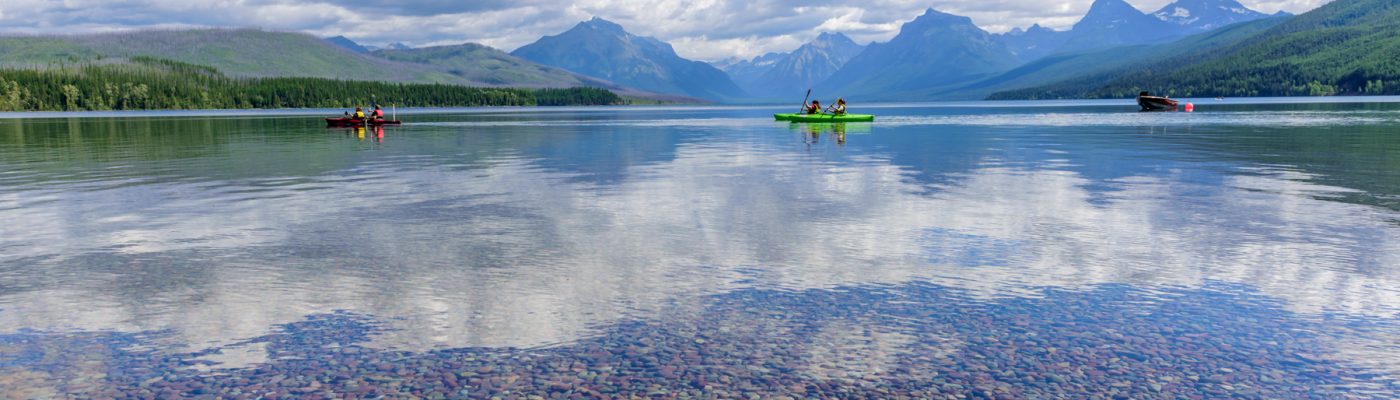
Glacier national park is located in the northwestern part of U.S.A. in the state of Montana and borders Waterton Lakes national park in Canada. The two parks are known as Waterton-Glacier International Peace Park, world’s first International Peace Park.

Stay
Within Glacier national park you have lodging near Lake McDonald (west of the park) and near St.Mary lake and Swiftcurrent lake (east of the park). You can book these accommodations by visiting this link.
Unable to get a booking within the park? Stay in one of the small towns outside the park. To the west of Glacier national park you have the towns of West Glacier, Columbia Falls, and Whitefish, and to the east you have Babb, St.Mary, Browning, and East Glacier Park Village.
We stayed in Whitefish for a few days and then drove the Going-to-the-Sun road to the eastern part of the park and halted in Babb for three days.

Best short hikes in Glacier National Park
Lake McDonald Valley
Sacred Dancing Cascades – Sacred Dancing Cascades is a series of rapids in McDonalds creek along Going-to-the-Sun road. Turquoise waters cascading down colored rocks is quite a scene.
There is a viewing platform right near the pullout. For a frontal view, you need to walk two minutes from the parking area to a footbridge. Not much of a hike here, but you can stroll on the footbridge to the other side and back to the parking area—approximate distance of a mile.


Trail of the Cedars – Less than a mile loop. Trail of the Cedars is along a raised boardwalk through a forest of red cedar and hemlock. On the way you pass Avalanche creek flowing through Avalanche gorge—turquoise waters gushing through pinkish red rocks covered in green moss—a popular place for photographers.

Avalanche lake – This picturesque clear lake can be reached by hiking approximately 2 miles (one way) from the trail of the cedars. The trail meanders through a forest and is only 500 feet of elevation gain.

Logan Pass
Hidden lake overlook – 2.8 miles roundtrip with approximately 460 feet of elevation gain. Trailhead is behind Logan pass visitor center.
This is the best place (I have been told) where you will find mountain goats, snow fields (early summer), wildflowers, and occasionally Bighorn sheep and grizzlies. And if at all a grizzly with cubs is sighted around here, expect the trail to be closed. Exactly what happened on the day of our hike, because of which we couldn’t get to the lake overlook.

St.Mary
St.Mary falls – Aquamarine colored waterfall? No wait, I think it’s turquoise in color. Well, decide for yourself. A short hike (approximately 2miles round trip) will take you to the beautiful St.Mary falls. Trailhead is marked as ‘St.Mary falls’ and is on the right side on Going-to-the-Sun road while driving from Logan pass to St.Mary. Parking area is pretty small and often full, but I would suggest you to wait to get a spot.
If you decide to continue on this trail, after a mile you will reach Virginia falls.


Unnamed trail on the shores of St.Mary lake – Approximate length of the trail is 1mile. This wonderful picnic area is right across from the Rising Sun Motor Inn. Right behind the picnic area is a narrow trail through the trees. This short trail ends on a small pristine beach of St.Mary lake—gorgeous blue waters, multi-colored pebbles, nippy air, sweeping mountain vistas, and nobody around!

Many Glacier
Grinnell lake – There are two ways to reach Grinnell lake. Either take the boat (book in advance) from Many Glacier and hike 1 mile (one way) from the shores of lake Josephine, or take the Grinnell glacier trailhead near Many Glacier hotel. Add an additional 2.3 miles each way if you choose the second option.
This easy hike will take you to the teal colored Grinnell lake. This coloration of Grinnell lake is due to the rock flour from Grinnell glacier.


Two Medicine Lake
Running Eagle falls/Trick falls – 0.6 miles round trip. Running Eagle falls is also called Trick falls because there are actually two waterfalls: one flows through a cave and the other one flows directly above it. However, if there isn’t much water coming from the mountains there will be only one waterfall.
When we were here in the first week of July there was only one waterfall, the one spilling out through the cave.


Want more? How about taking these not-so-short, breathtaking hikes –
Iceberg lake – 9.6 miles roundtrip
Grinnell glacier viewpoint – 7.2 miles roundtrip if you take the Many Glacier boat, else 10.6 miles roundtrip
Swiftcurrent Pass trail – 13.6 miles roundtrip
Cracker lake – 12.8 miles roundtrip
Remember, this is bear country! Be vigilant, hike in groups, make noise, and carry bear spray.

(We visited Glacier national park in July 2016)
For more pictures from Glacier national park, hover on the pic below and click on the arrow.
